Windows (NSIS / portable) & Linux (AppImage)
Review flights and export map overlays on one shared timeline.
The Drone Path desktop app puts your recording beside a synchronized 2D flight map. Open any clip, scrub frame by frame without waiting for tile warm-up, mark an In–Out passage, tune the map look live, and export video or telemetry tracks.
npm run build && npm run app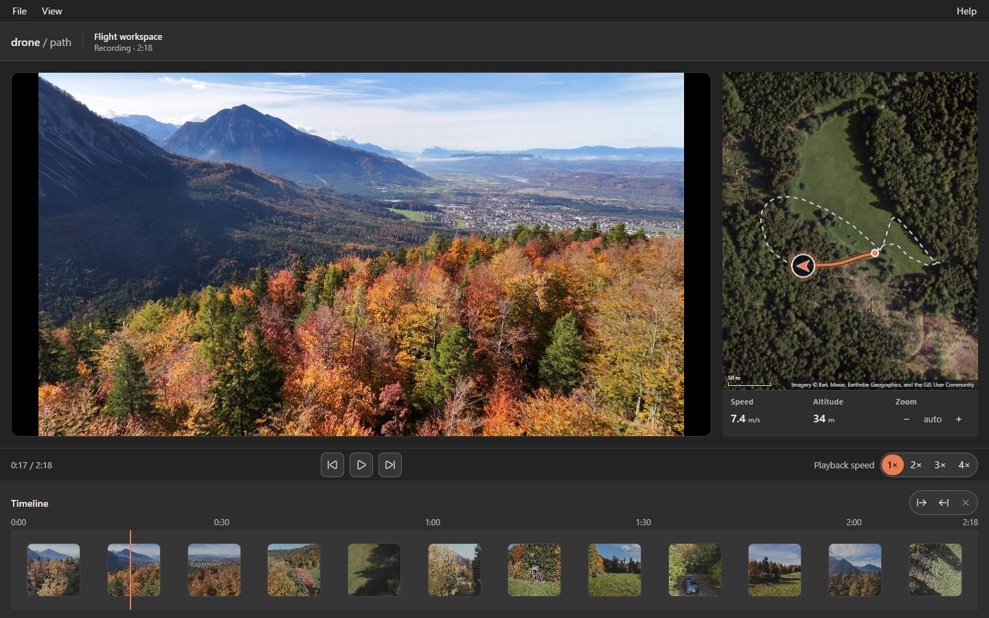
Review workspace
Instant open, split view, and Picture-in-Picture
As soon as a recording's telemetry is decoded, the flight trail draws immediately while map tiles stream on demand—playback never stalls waiting for tiles.
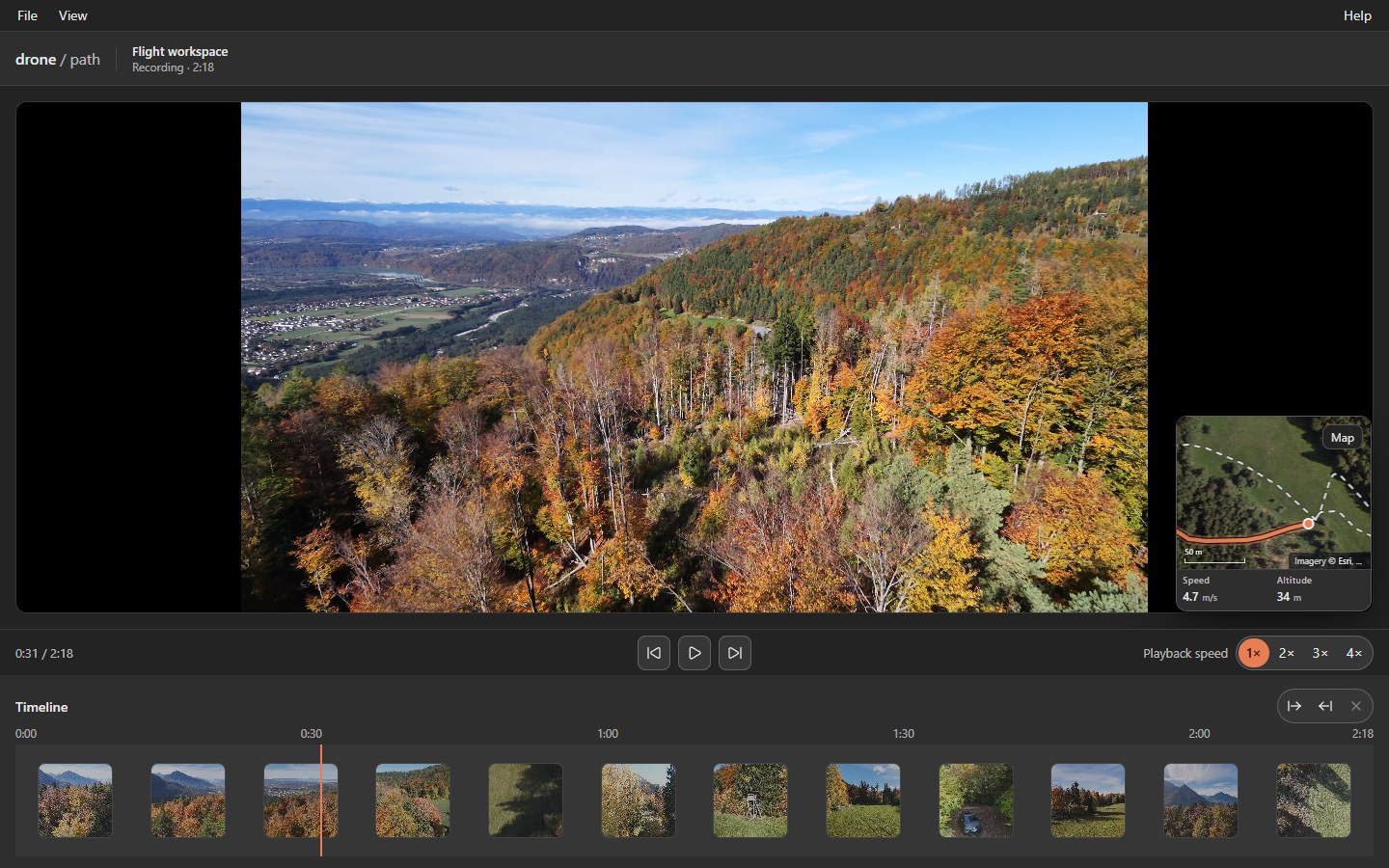
Full-frame footage with corner map overlay
Press P or choose View → Picture in picture to collapse the map into a compact corner card over your drone footage. Play, pause, and scrubbing drive both panes from the same timeline so the footage and map never drift apart.
- Compact readout strip: Displays live Speed, Altitude, and the Zoom stepper (auto-fit or pinned levels 2–19).
- Compact window support: Every workspace and dialog fits cleanly down to 1024×600.
- Bundled FFmpeg: Ships with FFmpeg and FFprobe; video export uses system Google Chrome or Microsoft Edge.
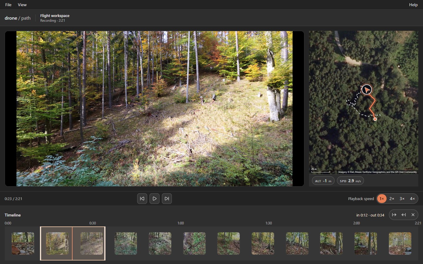
Mark In–Out passages for looping and export
Press I to set an in point and O to set an out point—or drag the handles directly on the filmstrip. A single point marks a passage to the end or from the start of the clip.
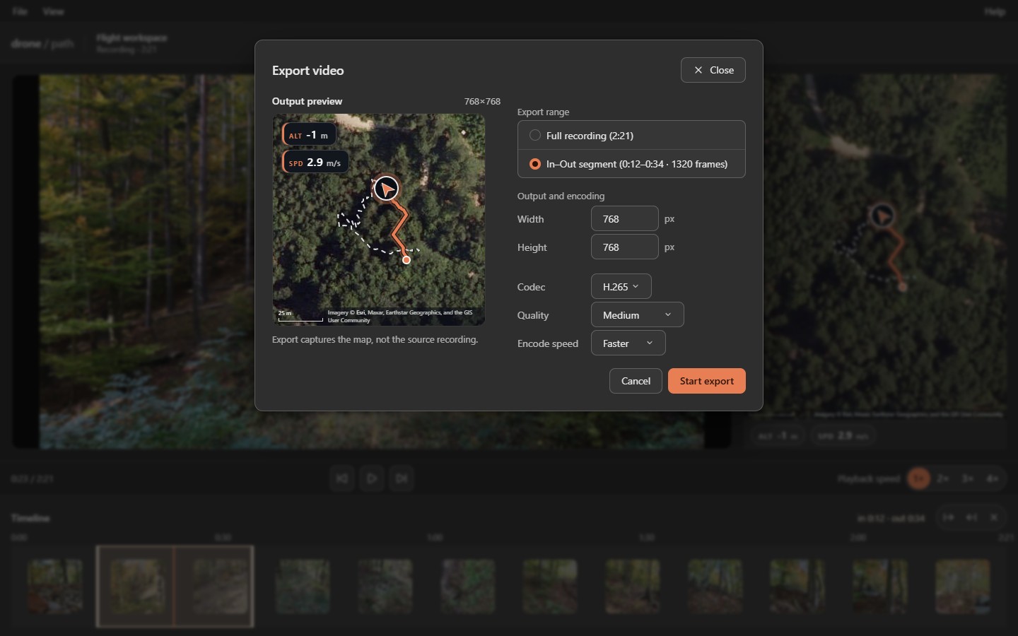
Marked passages repeat automatically during review and carry straight into both Export video… and Export telemetry…, so you only render or save the exact segment you need.
Customization
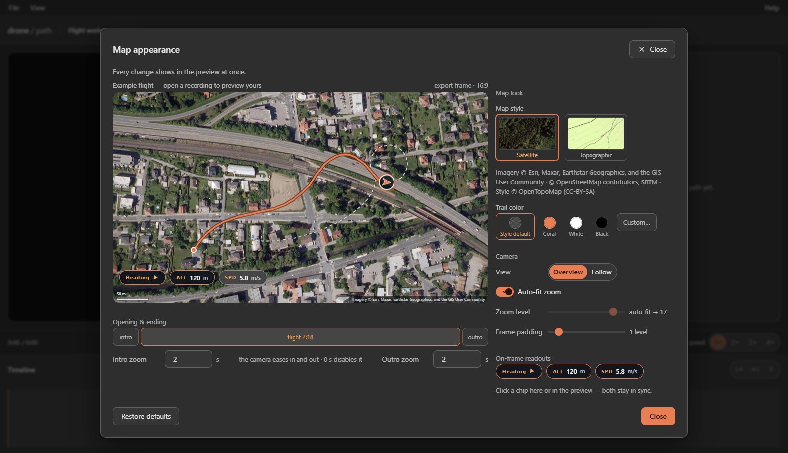
Live map appearance and deterministic export
Tune map styles, camera behavior, HUD readouts, and easing beside a live 16:9 export preview before encoding.
Keyboard & accessibility
Full keyboard control across player and menu bar
Every transport command, timeline marker, zoom step, and menu item is reachable from the keyboard, paired with an offline user manual under Help → User manual and automatic updates for packaged releases.
| Keys | Action |
|---|---|
| Space / K | Play or pause playback |
| 1 2 3 4 | Set playback speed to 1x, 2x, 3x, or 4x |
| Left / Right | Step backward or forward one frame |
| Shift+Left / Shift+Right | Jump backward or forward one second |
| Home / End | Jump to the start or end of the recording |
| I / O | Set the in point or out point |
| Esc | Close an open menu or dialog, or clear in and out points |
| P | Toggle Picture-in-Picture corner map overlay |
| + / - | Step map zoom in or out one level (levels 2 to 19) |
| Ctrl+O | Open a drone recording (works even in empty workspace or while typing) |
| Alt, Alt+F, Alt+V, Alt+H | Open the menu bar or jump directly to File, View, or Help |